Monitor New York Traffic in Real-Time
New York State features some of the most complex traffic in America—from the intense gridlock of Manhattan to the blinding lake-effect snow of Buffalo. Access 4500+ live traffic cameras throughout the Empire State. In addition to major highways, you can monitor live street cameras and road-level views across the five boroughs and regional transit hubs. View real-time conditions on the NY Thruway, I-87, I-95, and all major Upstate arteries. Whether you're commuting across town or traversing the state, live cameras provide the visual intelligence you need to stay safe.
VIEW NY CAMERAS →Watch live
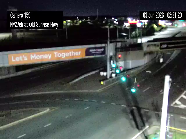
Click any camera to open the live feed. Static thumbnails refresh periodically.
Real-Time Visibility from NYC to the Great Lakes
New York's transportation network is anchored by the 570-mile New York State Thruway system, connecting the world's largest financial hub to the industrial centers of the North and West. The state maintains a vast infrastructure of over 113,500 public road miles according to FHWA statistics, making it one of the most extensive and diverse systems in the country. With a population of nearly 20 million, the state's roads are among the busiest in the nation. TrafficVision.Live provides instant, free access to thousands of feeds, giving you ground-truth visibility into road conditions, weather impacts, and construction delays.
Metropolitan & Regional Coverage
New York's camera network is organized by region, reflecting the diverse driving environments found across the state.
New York City Metro
2,500+ Live Cameras
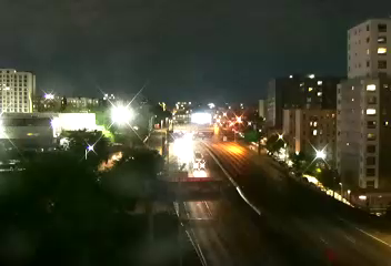
The highest density of cameras in the US. Monitor all five boroughs, the FDR Drive, BQE, Harrison, Mount Pleasant, and the primary Hudson River crossings.
Buffalo & Western NY
400+ Live Cameras
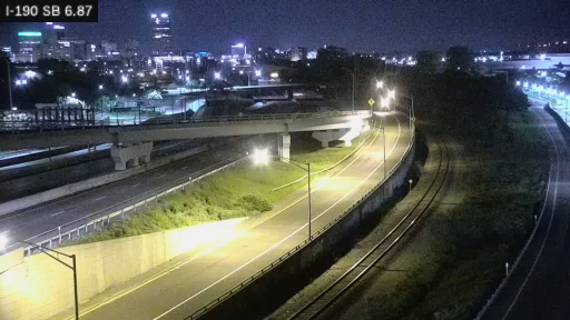
Essential monitoring for I-90, I-190, and the Niagara Thruway through Niagara Falls. Critical for tracking lake-effect snow accumulation.
Albany & the Northway
320+ Live Cameras
Strategic views of the state capital, the I-87/I-90 interchange, and the route north toward the Adirondacks and Lake Placid.
Rochester & Finger Lakes
280+ Live Cameras
Monitor the I-490/I-390 system, Brighton, and the Inner Loop serving the Rochester metropolitan area.
Syracuse & Central NY
220+ Live Cameras
Live views of the I-81 and I-690 junction, a major transit point for north-south and east-west travel.
Track the NY State Thruway
Don't get caught in a Thruway shutdown. Check the cameras for I-90 and I-87 before you start your cross-state trip.
VIEW THRUWAY CAMERAS →The New York State Thruway Backbone
The NYS Thruway (I-90 and I-87) is the lifeblood of New York travel. Monitoring specific sections is vital for long-distance drivers.
Major Thruway Corridors
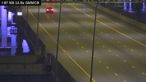
- I-87 (The Northway) — NYC to Canadian border; 50+ cameras spanning the Cuomo Bridge, Hudson Valley, Albany, and the Plattsburgh / Champlain approach. Paired north-south angles at the Cuomo Bridge plus Rockland and Westchester landing views.
- I-90 (The Mainline) — Albany to Buffalo across the width of the state; 70+ cameras concentrated at exit interchanges and service plazas with denser clusters at the Buffalo terminus (Peace Bridge approach), the Rochester I-490 split, the Syracuse I-81 junction, and the Albany interchange feeding the Berkshire Spur. Westbound from Albany to Buffalo touches a fresh camera every 25-40 miles on average.
- Mario Cuomo Bridge — Tappan Zee replacement at Tarrytown; multiple paired angles on both spans plus the I-87 interchange feed. Worth checking all of them during high-wind events when one span may close before the other.
- The Berkshire Spur — Connecting the Thruway to the Massachusetts Turnpike.
Feeder corridors and border crossings
Beyond the Thruway mainline, three corridor clusters round out cross-state visibility:
- I-190 Niagara Thruway and the Peace Bridge has 28 cameras covering the Buffalo waterfront approach to the US-Canada border crossing and the I-290 split that feeds the Niagara Falls Boulevard corridor. Paired southbound and northbound angles on I-190 plus the Porter Avenue interchange let you infer border-wait time from the southbound queue length.
- I-81 (Syracuse axis) has 38 cameras through the Syracuse core and the Onondaga Lake corridor, where the highway's elevated viaduct creates predictable weather-related visibility issues that the cameras catch before traffic data does.
- Long Island Expressway and Southern State Parkway together carry 80+ cameras across Nassau and Suffolk Counties, with paired-direction angles at every major exit from Queens Village out to the Hamptons. The I-495 at 220th Street cluster plus the Cross Island Parkway interchange cameras act as the trip-decision point for heading east on the LIE versus diverting to the Northern State or Southern State Parkways.
The Buffalo-to-NYC drive on the Thruway alone passes more than 50 distinct cameras, so a single saved route gives you continuous lookahead instead of having to refresh region-by-region.
Strategic Seasonal Monitoring
New York's weather and extreme traffic volumes are primary drivers of traffic incidents and delays. According to research from TRIP, New York recorded 1,111 traffic fatalities in 2023, with a fatality rate of 0.97 per 100 million Vehicle Miles Traveled (VMT), highlighting the need for vigilance during peak travel periods.
The I-95 and I-87 Corridors
The I-95 corridor through the Bronx is one of the highest-volume truck routes in the United States, serving as a critical artery for commerce throughout the Northeast. Meanwhile, I-87 connects the heart of Manhattan to the Canadian border, experiencing massive commuter surges in the metropolitan area.
The Lake-Effect Snow Belt
From November through March, the corridor from Buffalo to Syracuse is prone to sudden, localized whiteout conditions. Cameras allow you to see exactly where the "snow wall" begins, often when the weather report is still calling for clear skies.
NYC Commuter Congestion
In the metropolitan area, traffic follows a rigid peak-hour pattern. Monitoring the bridges and tunnels (GWB, Lincoln, Holland) is essential between 6:00 AM and 10:00 AM, and 3:30 PM and 7:30 PM.
Pro Tip: Bridge Levels
For major crossings like the George Washington Bridge or the Queensboro Bridge, always check both the Upper and Lower Level cameras. Traffic often flows significantly better on one level than the other.
Professional Monitoring Tools
Our New York directory is built for high-performance monitoring across all devices.

Empire State Map
High-density interactive map with real-time clustering for all 4500+ feeds.

Regional Filtering
Instantly narrow your view to "NYC Metro," "Upstate," or specific highway corridors.

Custom Favorites
Save your most-used cameras—like your morning thruway exit—for one-click access.

Multi-Source Feeds
We integrate NYSDOT, NYCDOT, and Thruway Authority data into a single seamless interface.

Night Sensitivity
High-performance sensors provide visibility even during late-night winter storms.

Rapid Loading
Optimized for mobile performance, ensuring visual data even in congested areas.
Build Your Custom NY Route
Traveling from Buffalo to Albany? Or Long Island to Manhattan? Build a custom route to see every camera along your specific path.
BUILD A ROUTE →About the New York Camera Network
TrafficVision.Live provides free access to 4500+ live traffic cameras throughout New York State. Our platform aggregates feeds from 511NY, the NYS Thruway Authority, and municipal DOTs. Tri-state and cross-border drivers can also pull up our breakdown of every state's 511 traffic camera system to chain 511NY into 511NJ, 511PA, 511CT, or VT511 without losing camera coverage. These cameras are part of the world's largest traffic camera directory with 140,000+ live feeds from 600+ official sources worldwide.
Whether you're planning your commute, checking current road conditions, or monitoring specific areas for traffic congestion, our New York State traffic camera network provides real-time visibility into the region's transportation infrastructure. You can also use these live feeds to play CamGuessr — watch a random camera and try to guess where in the world it is. Drivers can also access real-time street feeds at critical intersections to navigate around surface street gridlock in dense urban centers. View live feeds from major routes including I-87, I-90, I-95, FDR Drive, West Side Highway, Brooklyn-Queens Expressway, Long Island Expressway, and the New York State Thruway.
Who operates the traffic cameras in New York?
Cameras are operated by a mix of agencies, including the New York State DOT, NYC DOT, and the New York State Thruway Authority.
Where can I find New York street cameras?
You can access live street cameras throughout NYC and other major metros by using our interactive map. These feeds provide road-level views of intersections and surface streets alongside traditional highway monitoring.
How often do the NY cameras update?
Most cameras update their images every 30 to 60 seconds. During severe weather events, some cameras may provide more frequent refreshes.
Can I see traffic on the Mario Cuomo Bridge?
Yes, there are several high-definition cameras monitoring the bridge deck and the approaches on both the Westchester and Rockland sides.
Are these cameras used for speeding tickets in NY?
No, the DOT and Thruway cameras shown on TrafficVision.Live are used for traffic management and public information only. They are not used for automated speed enforcement.
Is there a fee to access the NYC camera network?
No, all feeds provided through TrafficVision.Live are free for public use and do not require a subscription.
Ready to View NY Traffic Cameras?
Why sit in gridlock when you could have checked the street cameras first? Live road-level views show conditions before you commit to a route.
START VIEWING NOW →